Agridisk
Egypt - Alexandria
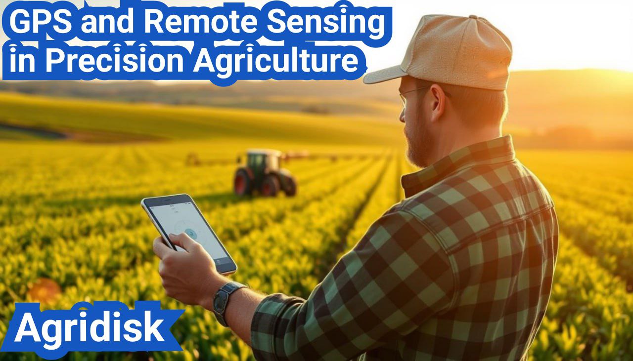
GPS and Remote Sensing in Precision Agriculture
Description: Precision agriculture is revolutionizing farming practices by enabling farmers to manage their land more effectively. This approach involves using advanced technologies to optimize crop yields and reduce waste. Precision farming technologies are at the forefront of this change, providing farmers with the tools they need to make data-driven decisions. The integration of GPS and remote sensing in precision agriculture has been particularly impactful. These technologies allow for the precise application of resources, such as water and fertilizers, and enable farmers to monitor crop health remotely. As a result, farmers can respond quickly to issues, improving overall crop yields and reducing environmental impact. The evolution of precision agriculture is marked by the adoption of innovative technologies that enable farmers to make data-driven decisions. Precision agriculture involves the use of advanced technology to manage variability in crops and optimize resource use, representing a significant shift in farming practices. Precision agriculture is defined by its use of GPS, GIS, and remote sensing technologies to gather and analyze data on crop health, soil conditions, and other factors affecting farm productivity. At its core, precision agriculture aims to: By leveraging these technologies, farmers can gain a more nuanced understanding of their fields, allowing for more precise application of resources such as water, fertilizers, and pesticides. Precision farming has undergone significant evolution since its inception. The introduction of GPS technology in the 1990s marked the beginning of a new era in agriculture, enabling farmers to navigate and manage their fields with greater precision. The subsequent development of remote sensing technologies further expanded the capabilities of precision agriculture, allowing for the collection of detailed data on crop health and growth. Today, precision agriculture continues to evolve with advancements in data analytics, drones, and automation, offering new opportunities for farmers to enhance efficiency and productivity. Key milestones in the evolution of precision farming include: As precision agriculture continues to advance, it is likely to play an increasingly important role in meeting the world's growing food demands sustainably. The integration of GPS in agriculture has transformed farming practices, enhancing efficiency and productivity. GPS technology provides farmers with the ability to navigate their fields with precision, reducing overlap and ensuring that every part of the field is treated appropriately. GPS works by using a network of satellites orbiting the Earth, which transmit signals that are received by GPS receivers on the ground. In agricultural settings, these receivers are typically mounted on tractors or other farming equipment. The signals from multiple satellites are used to calculate the exact position of the receiver, allowing for precise navigation and mapping. Precision is key in these applications, as small deviations can lead to significant inefficiencies or losses. For instance, GPS guidance systems help farmers to drive in straight lines, reducing the overlap of seed, fertilizer, and pesticide applications. There are several types of GPS systems used in farming, including: Each of these systems has its own advantages and is suited to different farming practices and requirements. The level of GPS accuracy required can vary significantly depending on the specific application. For example, guidance systems for tractor steering may require accuracy to within a few meters, while precision planting and crop monitoring may require accuracy to within a few centimeters. RTK GPS systems are often used for applications requiring the highest accuracy, such as in precision agriculture where the exact placement of seeds or fertilizers is crucial. Understanding the GPS accuracy requirements for different agricultural applications is essential for selecting the right GPS technology and ensuring that it meets the needs of the farm. Agricultural remote sensing involves the use of various technologies to collect data about crops and soil, enabling more informed farming decisions. This approach has transformed the way farmers manage their fields, allowing for more precise and efficient use of resources. Remote sensing technologies used in agriculture include satellite imagery, aerial photography, and drone-based sensing. Each of these technologies has its own strengths and is suited to different applications. Spectral signatures are critical in crop monitoring as they help in identifying the health and status of crops. Different crops and conditions reflect light differently across various spectral bands. "The use of spectral signatures in agriculture allows for the early detection of stress and disease in crops, enabling timely intervention." - Expert in Precision Agriculture. Data collection in remote sensing involves various methods, including passive and active sensing. Passive sensing involves measuring reflected sunlight, while active sensing uses its own light source. Effective data collection is crucial for the success of remote sensing applications in agriculture, enabling farmers to make data-driven decisions. The use of GIS in precision agriculture represents a significant advancement in the field, allowing for more efficient and effective farming practices. GIS technology provides a powerful tool for managing and analyzing the complex spatial data that is inherent in agricultural operations. GIS plays a crucial role in agricultural data management by enabling farmers to collect, store, and analyze various types of spatial data. This includes data on soil types, crop yields, and weather patterns, among others. By integrating these different data sets, farmers can gain a more comprehensive understanding of their operations and make more informed decisions. Key benefits of GIS in agricultural data management include: The integration of GPS and remote sensing data with GIS is a powerful approach that enhances the capabilities of precision agriculture. GPS provides accurate location data, while remote sensing technologies offer insights into crop health, soil moisture, and other factors. By combining these data sources within a GIS framework, farmers can create detailed maps and models that inform their farming practices. The process of integrating GPS and remote sensing data with GIS involves: Spatial analysis is a critical component of GIS in precision agriculture, enabling farmers to analyze and interpret the complex spatial data that underlies their operations. By applying spatial analysis techniques, farmers can identify patterns and trends that might not be apparent through other means. This information can then be used to inform decisions on crop management, irrigation, and other aspects of farm operations. Examples of spatial analysis in farm decision-making include: By leveraging GPS mapping, farmers can now analyze and manage their fields with unprecedented precision. GPS mapping in agriculture has become a crucial tool for optimizing crop yields, reducing waste, and improving overall farm efficiency. One of the primary applications of GPS mapping in agriculture is the creation of accurate field boundary maps. These maps help farmers define the boundaries of their fields, identify areas that require specific attention, and plan their farming operations more effectively. By using GPS technology, farmers can create detailed maps that include information about the terrain, soil types, and other relevant factors. GPS mapping is also used for soil sampling and mapping, which involves collecting and analyzing soil samples to determine their nutrient content, pH levels, and other characteristics. This information is then used to create detailed soil maps that help farmers identify areas with specific soil conditions and develop targeted fertilization strategies. By optimizing fertilizer application, farmers can reduce waste, minimize environmental impact, and improve crop yields. Yield mapping is another critical application of GPS mapping in agriculture. By using GPS-enabled yield monitors, farmers can collect data on crop yields in different parts of their fields. This information is then used to create detailed yield maps that help farmers identify areas with high and low yields, analyze the factors contributing to these variations, and develop strategies to optimize crop production. Yield mapping enables farmers to make data-driven decisions, reduce costs, and improve their overall profitability. The use of remote sensing in agriculture enables farmers to monitor crop health more effectively. Remote sensing technologies, including various types of sensors and imaging techniques, provide valuable data on crop conditions, helping farmers make informed decisions. Vegetation indices are crucial for crop monitoring. They are derived from multispectral or hyperspectral imagery and help in assessing crop health, growth, and development. The Normalized Difference Vegetation Index (NDVI) is one of the most commonly used indices, providing insights into vegetation vigor and density. NDVI values range from -1 to 1, where higher values indicate healthier and denser vegetation. Other indices like the Enhanced Vegetation Index (EVI) and the Soil Adjusted Vegetation Index (SAVI) also offer valuable information on crop conditions. Remote sensing is also effective in detecting plant stress and disease. By analyzing changes in reflectance patterns, farmers can identify issues before they become visible to the naked eye. Thermal imaging, for instance, can detect temperature variations in crops, indicating stress or disease. Nutrient deficiencies can significantly impact crop health and yield. Remote sensing technologies can identify these deficiencies by analyzing the spectral signatures of crops. For example, nitrogen deficiency can be detected through changes in leaf reflectance. By using remote sensing for nutrient deficiency identification, farmers can apply fertilizers more precisely, reducing waste and environmental impact. The integration of GPS and remote sensing technologies is revolutionizing precision agriculture by enabling farmers to make more informed decisions and optimize their farming practices. Data fusion techniques play a crucial role in combining GPS and remote sensing data to create comprehensive insights into farm conditions. By integrating these data sources, farmers can gain a more detailed understanding of their fields, including soil moisture levels, crop health, and nutrient deficiencies. Types of Data Fusion: Prescription maps are a critical output of integrated GPS and remote sensing data. These maps provide detailed instructions for variable rate applications of fertilizers, pesticides, and irrigation, ensuring that resources are used efficiently and effectively. Decision Support Systems (DSS) are software platforms that analyze data from various sources, including GPS and remote sensing, to provide actionable recommendations to farmers. DSS can help in planning planting schedules, predicting yields, and managing resources more effectively. The key components of DSS include: By leveraging integrated approaches that combine GPS and remote sensing data, farmers can significantly enhance their precision agriculture practices, leading to improved yields, reduced waste, and more sustainable farming operations. Precision agriculture has taken a significant leap forward with the advent of GPS-guided machinery and equipment. This technology has enabled farmers to optimize their farming practices, leading to increased efficiency and productivity. GPS-guided machinery includes several key components that work together to enhance farming operations. These components include: Auto-steering systems utilize GPS signals to guide farming equipment with high precision. This technology reduces driver fatigue, minimizes overlap, and ensures that farming operations are carried out accurately. The benefits of auto-steering systems include: VRT is a technology that allows farmers to apply inputs such as seeds, fertilizers, and pesticides at varying rates across a field. This is achieved by using GPS data to create detailed maps of the field, which are then used to control the application rate of the inputs. The advantages of VRT include: Section control systems are designed to prevent overlap and reduce waste by automatically turning off sections of farming equipment when they overlap with previously treated areas. This technology is particularly useful in reducing the application of unnecessary inputs. The key benefits of section control systems are: Drone technology is increasingly being adopted in agricultural remote sensing due to its versatility and efficiency. Drones, or unmanned aerial vehicles (UAVs), are being used to enhance crop monitoring, soil analysis, and farm management. Agricultural drones can be broadly categorized into two types: fixed-wing drones and rotary-wing drones. Fixed-wing drones are ideal for large-area coverage and are often used for tasks such as crop monitoring over vast fields. On the other hand, rotary-wing drones offer greater maneuverability and are used for detailed inspections and applications requiring hovering capabilities. Drones used in agriculture are equipped with a variety of sensors and cameras, including: These sensors enable farmers to gather critical data on their crops, facilitating informed decision-making. Effective flight planning is crucial for successful drone-based remote sensing. Factors such as flight altitude, speed, and overlap are carefully considered to ensure comprehensive data collection. Modern drone software often includes features for automated flight planning, making it easier to execute complex missions. By leveraging drone technology, farmers can significantly improve their agricultural practices, leading to increased efficiency and productivity. Implementing precision agriculture technologies requires a strategic approach to maximize their benefits. This involves a series of steps that help farmers effectively integrate these technologies into their existing practices. The first step in implementing precision agriculture technologies is to assess the farm's needs and resources. This includes evaluating the farm's size, crop types, and existing equipment. Farmers should identify areas where precision agriculture can bring the most value, such as improving crop yields or reducing input costs. Farmers should also consider their resources, including budget, labor, and technical expertise. This assessment will help determine the most suitable precision agriculture technologies and guide the implementation process. Once the farm's needs and resources have been assessed, the next step is to select the appropriate precision agriculture technologies. This may include GPS guidance systems, remote sensing technologies, or data management software. The choice of technology will depend on the specific needs and goals of the farm. Farmers should research and compare different technologies, considering factors such as cost, compatibility, and user support. It's also essential to evaluate the potential return on investment for each technology. Integrating precision agriculture technologies with existing farm management practices is crucial for successful implementation. This involves incorporating the new technologies into the farm's operational workflow and ensuring that they complement existing practices. Farmers should consider how the new technologies will be used in conjunction with existing equipment and management systems. This may involve updating or modifying existing practices to ensure seamless integration. The final step is to consider training and support needs. Precision agriculture technologies can be complex, and farmers may require training to effectively use them. It's essential to provide adequate training and support to ensure that farmers can maximize the benefits of these technologies. Farmers should also consider the level of technical support provided by the technology vendors, including customer service, maintenance, and troubleshooting. This support is critical for resolving any issues that may arise during implementation and ensuring the long-term success of the precision agriculture technologies. The integration of technology in farming, known as precision agriculture, is enhancing sustainability by reducing waste, improving crop yields, and promoting eco-friendly practices. Precision agriculture contributes significantly to environmental sustainability. By using GPS and remote sensing technologies, farmers can optimize the use of water, fertilizers, and pesticides, thereby reducing the environmental footprint of farming activities. Precision irrigation systems, for example, ensure that water is delivered directly to the roots of plants, minimizing evaporation and runoff. The use of precision farming techniques also helps in reducing soil erosion and degradation. By maintaining soil health through targeted fertilizer application and crop rotation, farmers can improve soil structure and fertility, leading to better crop productivity and reduced environmental impact. Precision agriculture not only benefits the environment but also enhances the economic viability of farming operations. By optimizing resource use and improving crop yields, farmers can increase their profitability. Variable Rate Technology (VRT) allows for the precise application of inputs based on soil type, crop health, and other factors, reducing waste and improving efficiency. Moreover, precision agriculture enables farmers to make data-driven decisions, reducing the reliance on guesswork and intuition. This data-driven approach can lead to significant cost savings and improved farm management practices. The adoption of precision agriculture technologies also has social implications. While it may lead to job displacement in certain areas, such as manual labor, it also creates new opportunities in technology development, data analysis, and farm management. Furthermore, precision agriculture can contribute to food security by improving crop yields and quality. This is particularly important in regions where food scarcity is a concern. By ensuring that farming practices are sustainable and productive, precision agriculture can play a crucial role in meeting the world's food needs. The application of precision agriculture technologies spans multiple farming systems, enhancing productivity and efficiency. This section explores how different farming systems benefit from precision agriculture, focusing on row crops, orchards, vineyards, and livestock grazing management. Precision agriculture has significantly impacted row crop farming by improving crop yields and reducing input costs. Techniques such as GPS-guided planting, variable rate application of fertilizers and pesticides, and yield monitoring have become common practices. GPS-guided planting allows for accurate seed placement, reducing waste and improving germination rates. Variable rate technology enables farmers to apply inputs based on the specific needs of different areas within a field, optimizing resource use. In orchard and vineyard management, precision agriculture technologies are used to monitor crop health, optimize irrigation, and manage pests and diseases. Remote sensing technologies, including drones equipped with multispectral or RGB cameras, provide detailed insights into crop conditions. These applications help in making informed decisions, reducing the environmental impact of farming practices, and improving the quality of produce. Precision agriculture is also applied in livestock and grazing management to improve pasture utilization and animal health. Technologies such as GPS tracking and monitoring systems help farmers manage grazing patterns more effectively. GPS tracking of livestock allows farmers to monitor the movement and health of their animals in real-time, enabling better grazing management and reducing the risk of overgrazing. By adopting these technologies, farmers can enhance the sustainability of their operations, improve productivity, and contribute to a more efficient food production system. Precision agriculture, while revolutionary, is not without its technical, economic, and data-related challenges. As the agricultural sector continues to adopt these technologies, understanding and addressing these challenges is crucial for their successful implementation. The technical challenges in precision agriculture are multifaceted. One of the primary issues is the complexity of integrating various technologies, such as GPS, remote sensing, and GIS. Ensuring that these systems work seamlessly together can be daunting. Moreover, the accuracy and reliability of the data collected through these technologies can be affected by various factors, including satellite signal availability and weather conditions. The adoption of precision agriculture technologies is also hindered by significant economic barriers. The initial investment required for purchasing equipment and implementing these technologies can be substantial. Furthermore, the return on investment (ROI) may not be immediately apparent, making it challenging for farmers to justify the expenses. Precision agriculture generates vast amounts of data, raising concerns about data management and privacy. Farmers must navigate issues related to data ownership, storage, and security. Establishing clear guidelines and regulations regarding data handling is essential to build trust among farmers and encourage the adoption of precision agriculture technologies. Precision agriculture has revolutionized farming practices by leveraging advanced technologies like GPS and remote sensing. The integration of these technologies has significantly improved crop yields, reduced waste, and enhanced sustainability. As discussed, GPS technology provides accurate location data, while remote sensing enables the monitoring of crop health and growth. The future of precision agriculture looks promising, with potential advancements in technology expected to further improve farming practices. The development of more sophisticated GPS systems, remote sensing technologies, and data analytics tools will be crucial in shaping the precision agriculture future. By addressing current challenges and limitations, the agricultural industry can continue to benefit from these innovations, leading to more efficient and sustainable farming practices. In the modern era of farming, GPS and Remote Sensing in Precision Agriculture are driving an agricultural revolution. Farmers are no longer relying solely on manual observation and intuition. Instead, they leverage technology to gather, analyze, and act on real-time data, resulting in improved yields and better resource management. Precision agriculture relies heavily on two pillars of modern technology: GPS and remote sensing. These tools work hand-in-hand to transform farming from a traditional practice to a data-driven, highly efficient system. Read more about how remote sensing data is used in farming here. What Is GPS and Remote Sensing in Precision Agriculture? To fully understand the power of GPS and Remote Sensing in Precision Agriculture, we need to explore what these terms mean. GPS, or Global Positioning System, allows farmers to pinpoint exact locations in their fields. It ensures that every inch of the farm is accounted for and managed accurately. On the other hand, remote sensing uses satellite or drone imagery to gather data about crop health, soil conditions, and environmental changes. When combined, these two technologies give farmers unprecedented insight into their operations. Discover more about how GPS technology is changing agriculture here. The Role of GPS in Precision Agriculture GPS and Remote Sensing in Precision Agriculture rely on GPS for accurate positioning. GPS-guided tractors and machinery can plant seeds, apply fertilizer, and manage crops with precision. Farmers use GPS data to create field maps, identify problem areas, and optimize planting patterns. For instance, variable rate technology (VRT) depends on GPS data to adjust inputs like water, seeds, and fertilizers based on the needs of different field zones. This leads to lower costs and higher yields. Explore how GPS mapping helps farmers boost productivity here. How Remote Sensing Works in Precision Agriculture While GPS gives precise locations, remote sensing provides visual and thermal information about those locations. In GPS and Remote Sensing in Precision Agriculture, satellites and drones collect images in different spectral bands, including infrared, to detect crop stress, water content, and nutrient deficiencies. These images allow farmers to take corrective action before issues escalate. For example, a stressed crop might not be visible to the human eye, but remote sensing reveals subtle changes in reflectance that signal trouble. Learn how drone-based remote sensing is transforming agriculture here. Benefits of GPS and Remote Sensing in Precision Agriculture The use of GPS and Remote Sensing in Precision Agriculture brings numerous benefits: Resource efficiency: Farmers can apply water, fertilizers, and pesticides exactly where they’re needed. Environmental protection: Targeted inputs reduce runoff and pollution. Increased yields: Healthier crops and timely interventions boost production. Cost savings: Precision reduces waste and operational expenses. These benefits create a win-win scenario for both farmers and the environment. Check out how precision farming helps conserve resources here. Data Integration and Decision-Making A key aspect of GPS and Remote Sensing in Precision Agriculture is integrating data into farm management systems. Farmers use software that combines GPS data with remote sensing imagery to generate actionable insights. For instance, decision support systems (DSS) analyze data and provide recommendations on irrigation, pest control, and fertilization. These decisions are based on real-time data, not guesswork. Explore data-driven farming and its benefits here. Challenges of Implementing GPS and Remote Sensing in Precision Agriculture Despite their promise, GPS and Remote Sensing in Precision Agriculture come with challenges. One major hurdle is the cost of equipment and data processing tools. Smaller farms might struggle to afford these technologies. Additionally, integrating GPS and remote sensing data requires skilled personnel who can interpret and act on the information. Data privacy and cybersecurity also present concerns. Learn about the challenges and solutions for precision farming here. Future Trends in GPS and Remote Sensing for Precision Agriculture The future of GPS and Remote Sensing in Precision Agriculture looks promising. Advances in artificial intelligence and machine learning are enabling even smarter data analysis. Autonomous machinery guided by GPS and drones will become more common, while remote sensing will offer higher-resolution images and real-time updates. Moreover, cloud-based platforms will simplify data sharing, helping farmers collaborate and adapt more quickly to changing conditions. Find out how AI and machine learning are shaping precision agriculture here. Examples of GPS and Remote Sensing Applications in Precision Agriculture Here are some real-world examples of GPS and Remote Sensing in Precision Agriculture: Yield mapping: GPS combines with yield monitors to track crop output in real time. Variable rate application: Remote sensing identifies nutrient deficiencies, and GPS guides fertilizer application. Field zoning: Farmers divide fields into management zones based on satellite data. Pest and disease detection: Early detection of pests and diseases through thermal imaging. These applications save time, money, and resources. Explore real-life use cases in precision agriculture here. Environmental Sustainability and GPS & Remote Sensing Sustainability is at the heart of GPS and Remote Sensing in Precision Agriculture. By using these technologies, farmers reduce their environmental footprint while maintaining productivity. Precision applications minimize overuse of chemicals and preserve soil health. Remote sensing also helps monitor carbon emissions and identify ways to sequester carbon in the soil, supporting climate-smart agriculture. Discover sustainable farming practices with precision tools here. Final Thought GPS and Remote Sensing in Precision Agriculture are not just trends—they’re the backbone of the modern farming revolution. These technologies offer farmers the tools they need to grow more food with fewer resources while protecting the environment. As technology continues to evolve, GPS and remote sensing will become even more integrated into every aspect of farming, shaping a more resilient and sustainable future for agriculture.
Key Takeaways
Understanding Precision Agriculture

Definition and Core Concepts
Evolution of Precision Farming
Fundamentals of GPS Technology in Agriculture

How GPS Works in Agricultural Settings
"The use of GPS guidance systems has been shown to reduce input costs by up to 10% and increase yields by ensuring optimal planting and harvesting practices."
Types of GPS Systems Used in Farming
GPS Accuracy Requirements for Agriculture
Remote Sensing Basics for Agricultural Applications

Types of Remote Sensing Technologies
Spectral Signatures in Crop Monitoring
Spectral Band Application in Crop Monitoring Visible (RGB) General crop health, growth stage Near-Infrared (NIR) Vegetation health, biomass Short-Wave Infrared (SWIR) Water content, soil moisture Data Collection Methods
Geographic Information Systems (GIS) in Precision Agriculture

Role of GIS in Agricultural Data Management
Integrating GPS and Remote Sensing Data with GIS
Spatial Analysis for Farm Decision Making
Analysis Type Description Application Spatial autocorrelation Analyzing the distribution of variables across the farm Identifying areas of high or low crop yield Buffer analysis Creating zones around specific features Planning irrigation systems Network analysis Optimizing routes and flows within the farm Streamlining equipment movement GPS Mapping in Agriculture

Creating Field Boundary Maps
Soil Sampling and Mapping
Yield Mapping Techniques
Remote Sensing for Crop Health Assessment

Vegetation Indices for Crop Monitoring
"The application of vegetation indices in precision agriculture has significantly improved crop monitoring and management practices." -
Detecting Plant Stress and Disease
Nutrient Deficiency Identification
GPS and Remote Sensing in Precision Agriculture: Integrated Approaches

Data Fusion Techniques
Creating Prescription Maps
Map Type Description Application Soil Fertility Maps Detailing nutrient levels across the field. Variable rate fertilizer application. Crop Health Maps Identifying areas of stress or disease. Targeted pesticide application. Irrigation Maps Showing soil moisture levels. Optimized irrigation scheduling. Decision Support Systems
GPS-Guided Machinery and Equipment

Auto-Steering Systems
Variable Rate Technology (VRT)
Section Control Systems
Drone Technology in Agricultural Remote Sensing

Types of Agricultural Drones
Drone Sensors and Cameras
Flight Planning and Data Collection
Drone Feature Description Benefit Multispectral Imaging Captures data beyond visible spectrum Enhanced crop health analysis Thermal Imaging Detects temperature variations Effective irrigation management High-Resolution RGB Imaging Provides detailed visual data Accurate crop monitoring and analysis Implementing Precision Agriculture Technologies: Step-by-Step Guide
Assessing Farm Needs and Resources
Selecting Appropriate Technologies
Integration with Existing Farm Management
Training and Support Considerations
Sustainable Precision Agriculture
Environmental Benefits of Precision Farming
Economic Sustainability Aspects
Social Impacts and Considerations
Applications Across Different Farming Systems
Row Crop Applications
Orchard and Vineyard Applications
Livestock and Grazing Management
Challenges and Limitations of Precision Agriculture Technologies
Technical Challenges
Economic Barriers
Data Management and Privacy Concerns
Conclusion
FAQ
What is precision agriculture, and how does it utilize GPS and remote sensing?
How does GPS technology work in agricultural settings?
What are the benefits of using remote sensing in precision agriculture?
How is GIS used in precision agriculture?
What are the applications of GPS mapping in agriculture?
How is remote sensing used for crop health assessment?
What are the benefits of using GPS-guided machinery and equipment?
How is drone technology used in agricultural remote sensing?
What are the challenges and limitations of precision agriculture technologies?
How can precision agriculture contribute to sustainable farming practices?
What are the applications of precision agriculture across different farming systems?
Conclusion of: GPS and Remote Sensing in Precision Agriculture